Lidar
Aerial Lidar (Light Detection and Ranging)
Aerial lidar (Light Detection and Ranging) is a remote sensing technology that uses lasers to measure the distance between an aircraft and the ground. It works by emitting a laser pulse and measuring the time it takes for the pulse to travel to the ground and back. By analyzing the reflection of the laser pulse, lidar systems can create a high-resolution map of the terrain, including the height and shape of objects on the ground
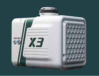
Aerial lidar systems are often mounted on planes or drones and can be used to collect data over large areas quickly and efficiently. The data collected by aerial lidar systems is used for a variety of applications, including mapping the topography of an area, creating digital elevation models, and identifying features such as buildings, roads, and vegetation.


Aerial lidar systems have several advantages over other remote sensing technologies. They can operate at a much higher resolution than satellite-based systems, allowing for the creation of highly detailed maps. They are also able to collect data in a variety of weather conditions, including clouds and fog. In addition, lidar systems are able to collect data at night, making them a useful tool for mapping and surveying in areas with limited daylight.
Drone lidar can provide a variety of benefits for customers depending on their needs. Some common applications of drone lidar include creating high-resolution maps and digital elevation models, surveying land for construction projects, inspecting infrastructure such as bridges and pipelines, and monitoring the health of crops and forests.

Using drone lidar, customers can quickly and efficiently collect data over large areas, reducing the time and cost associated with traditional surveying methods. Drone lidar can also provide detailed, accurate information about the topography and features of an area, enabling customers to make informed decisions about land use, planning, and development.
In addition, drone lidar allows customers to access hard-to-reach or dangerous locations, such as steep slopes or high elevations, without putting workers in harm’s way. This makes it a valuable tool for a variety of industries, including construction, engineering, agriculture, and natural resource management. Overall, drone lidar can provide valuable insights and data that can help customers make better decisions and improve the efficiency of their operations.
Lidar Point Cloud Data
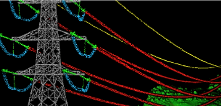
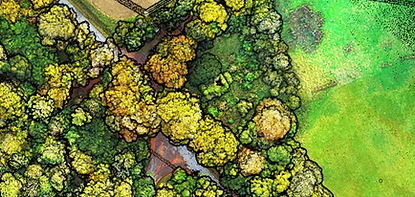
Lidar point cloud data refers to a set of data points that are generated by a lidar system as it scans an area. Each point in the cloud represents a specific location in the scan area, and the points are typically organized in a three-dimensional coordinate system. Lidar point cloud data can be used for a variety of applications, including creating high-resolution maps, creating digital elevation models, and identifying features such as buildings, roads, and vegetation.
One common use of lidar point cloud data is in the creation of digital terrain models (DTMs), which are used to represent the topography of an area. DTMs are often used in the construction, engineering, and natural resource management industries to help visualize and analyze the landscape. Lidar point cloud data can also be used to create 3D models of buildings and other structures, which can be useful for design and planning purposes.
In addition, lidar point cloud data can be used to detect and classify features such as vegetation, roads, and buildings, which can be useful for a variety of applications, including land use planning, environmental monitoring, and emergency response. Overall, lidar point cloud data is a valuable resource that can provide detailed information about the topography and features of an area, enabling users to make informed decisions and improve the efficiency of their operations.
There are several reasons why a client may want to consider using a drone lidar company. One key benefit of using drone lidar is the ability to quickly and efficiently collect data over large areas. Lidar systems use lasers to measure the distance between the drone and the ground, and can create a high-resolution map of the terrain, including the height and shape of objects on the ground. This makes them a valuable tool for a variety of applications, including creating high-resolution maps and digital elevation models, surveying land for construction projects, inspecting infrastructure such as bridges and pipelines, and monitoring the health of crops and forests.
Another reason to consider using a drone lidar company is the cost and time savings that can be achieved by using drones. Traditional methods of collecting lidar data, such as using handheld lidar scanners or flying planes equipped with lidar systems, can be expensive and time-consuming. By contrast, drone lidar systems can cover large areas in a short period of time, reducing the cost and effort required to collect data.
In addition, using a drone lidar company can provide access to specialized expertise and equipment that may not be readily available in-house. Drone lidar companies often have trained pilots and technicians who are familiar with the latest lidar technology and can provide valuable insights and guidance on how to best use the data collected by the drones.
Overall, using a drone lidar company can provide a cost-effective and efficient solution for collecting lidar data over large areas, enabling clients to make informed decisions and improve the efficiency of their operations.
Contact
Like what you see? Get in touch to learn more.
