Photogrammetry
Aerial drone photogrammetry is a remote sensing technique that uses images captured by drones to create maps, models, and other geospatial products. Photogrammetry involves using the principles of photography and geometry to measure and analyze the properties of objects and the environment.
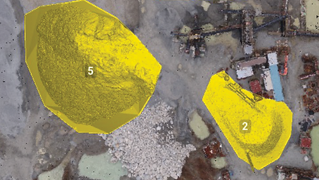
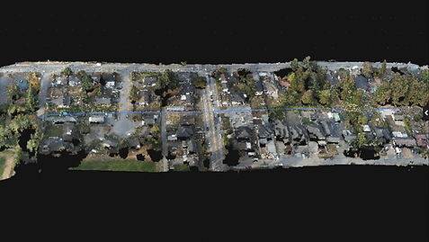
Aerial drone photogrammetry involves using drones to capture images of an area from different angles and perspectives. These images are then processed using specialized software, which uses the overlapping areas of the images to create a 3D model of the area. The 3D model can be used to create a variety of geospatial products, including maps, digital elevation models, and 3D models of buildings and other structures.

Aerial drone photogrammetry has several advantages over other remote sensing techniques. It allows for the collection of high-resolution images over large areas quickly and efficiently, and can be used to collect data in a variety of weather conditions. In addition, photogrammetry can be used to create detailed, accurate 3D models of the environment, which can be useful for a variety of applications, including land use planning, construction, and infrastructure management.
Overall, aerial drone photogrammetry is a valuable tool that can provide detailed information about the environment, enabling users to make informed decisions and improve the efficiency of their operations.

Aerial drone photogrammetry has several advantages over other remote sensing techniques. It allows for the collection of high-resolution images over large areas quickly and efficiently, and can be used to collect data in a variety of weather conditions. In addition, it can be used to create detailed, accurate 3D models of the environment, which can be useful for a variety of applications, including land use planning, construction, and infrastructure management.
Overall, aerial drone photogrammetry is a valuable tool that can provide detailed information about the environment, enabling users to make informed decisions and improve the efficiency of their operations.


Contact
Like what you see? Get in touch to learn more.
